blah blah blah
Pine Mountain
Length: 3.5 miles out-and-back with loopDifficulty (click for info): Moderate
Elevation Gain: 840 feet (+60 on return)
Rating (click for info): 8/10
Elevation: 2410'
Prominence: 780'
Driving Directions:
Trailhead and parking area are on Pinkham B Road in Gorham, NH. Pinkham B Road leaves the south side of Rt. 2 4.5 miles west of Rt. 16 and 8.0 miles east of Rt. 115. This is right at the base of Randolph Hill. Drive 2.5 miles up the road, which is paved in sections but also occasionally steep and rough. Park at the lot for the Pine Link Trail on the right side, directly across the road from the gated Pine Mountain Road, with signs for the Horton Center. Pinkham B Road can also be accessed from Rt. 16 in Martins Location, 4.4 miles south of Gorham. The trailhead is 1.9 miles from this side. Click here for a Google map.
About the Hike:
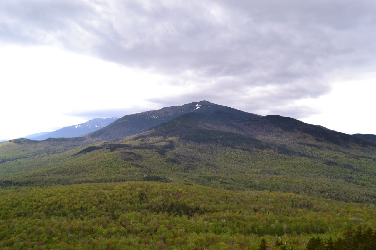
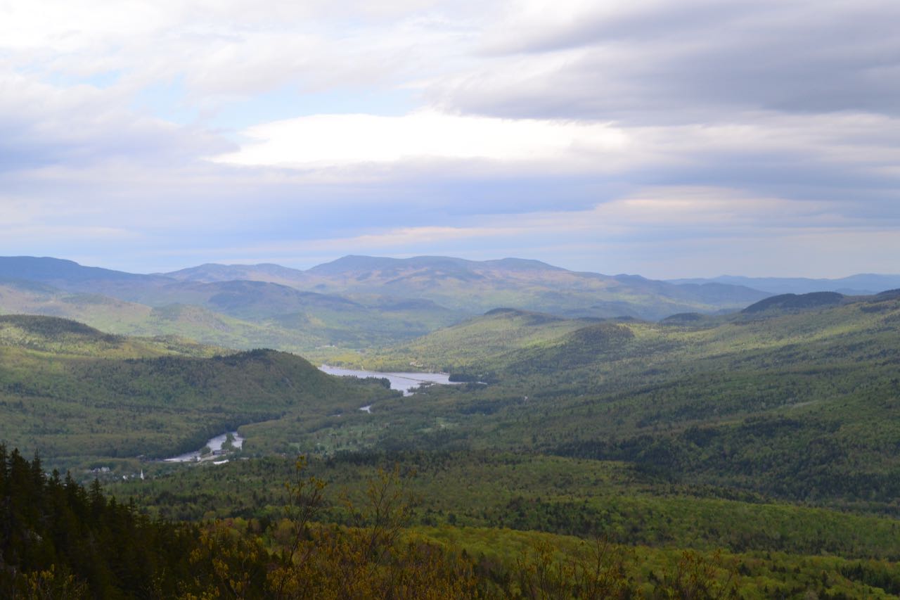
North of Mt. Washington, the main ridgeline of the Presidential Range is carried over the summits of Mts. Clay, Jefferson, Adams, and Madison. Mt. Madison is the last great alpine summit on the Northern Presidentials, and the ridgeline descends over the Howker Ridge toward the Androscoggin River and Gorham. But before reaching the valley floor, the ridge rises over one more summit: the northernmost peak in the Presidential Range - the low, ledgy Pine Mountain. The slopes of the mountain are striped with cliffs and ledges, and because of the close proximity to the higher peaks in the Northern Presidentials, it has magnificent views of their craggy, alpine summits and rock-strewn slopes. The summit of the mountain is owned by the Horton Center, a private camp and worship center. They have an extensive complex on a northern plateau of the mountain, but the hiking trails are organized in such a way that hikers can enjoy an amazingly scenic loop around the summit without ever knowing they are so close to civilization. Pine Mountain is one of the White Mountains' prime destinations below 2500' elevation, yet it is often overlooked for other more famous ones. The hike to Pine Mountain is packed with scenic ledges and fantastic views of rugged terrain and gentle valleys. It's an underappreciated classic.
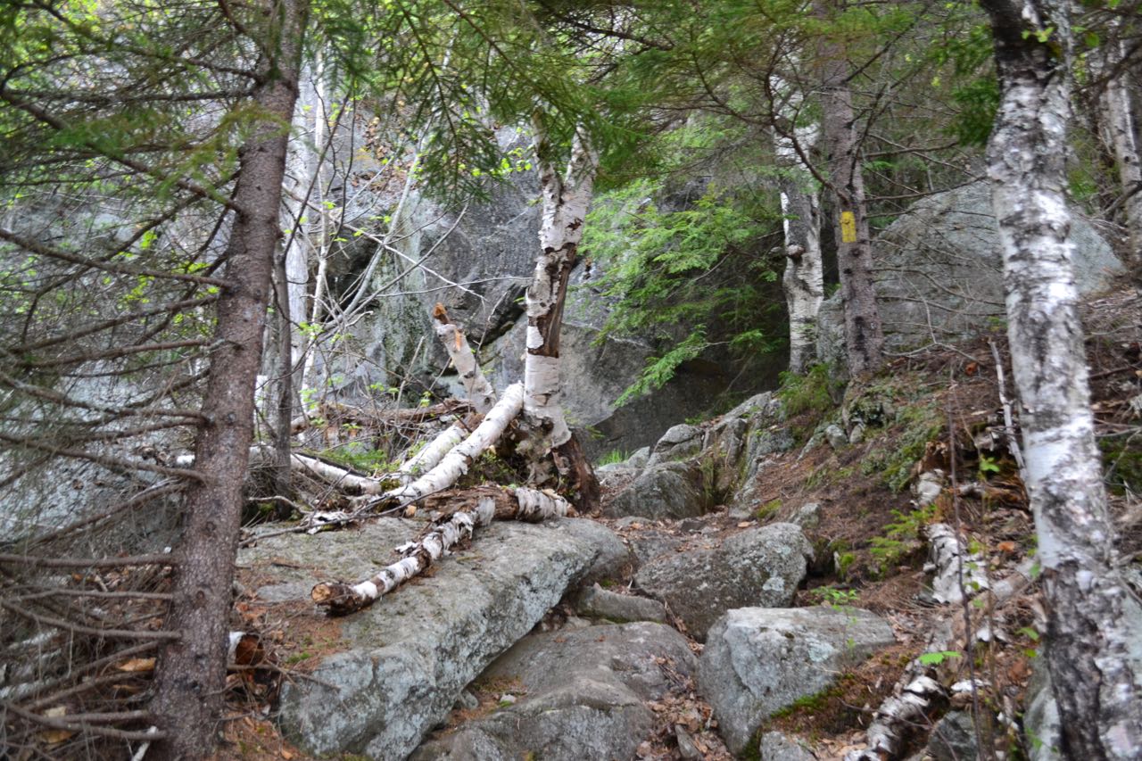
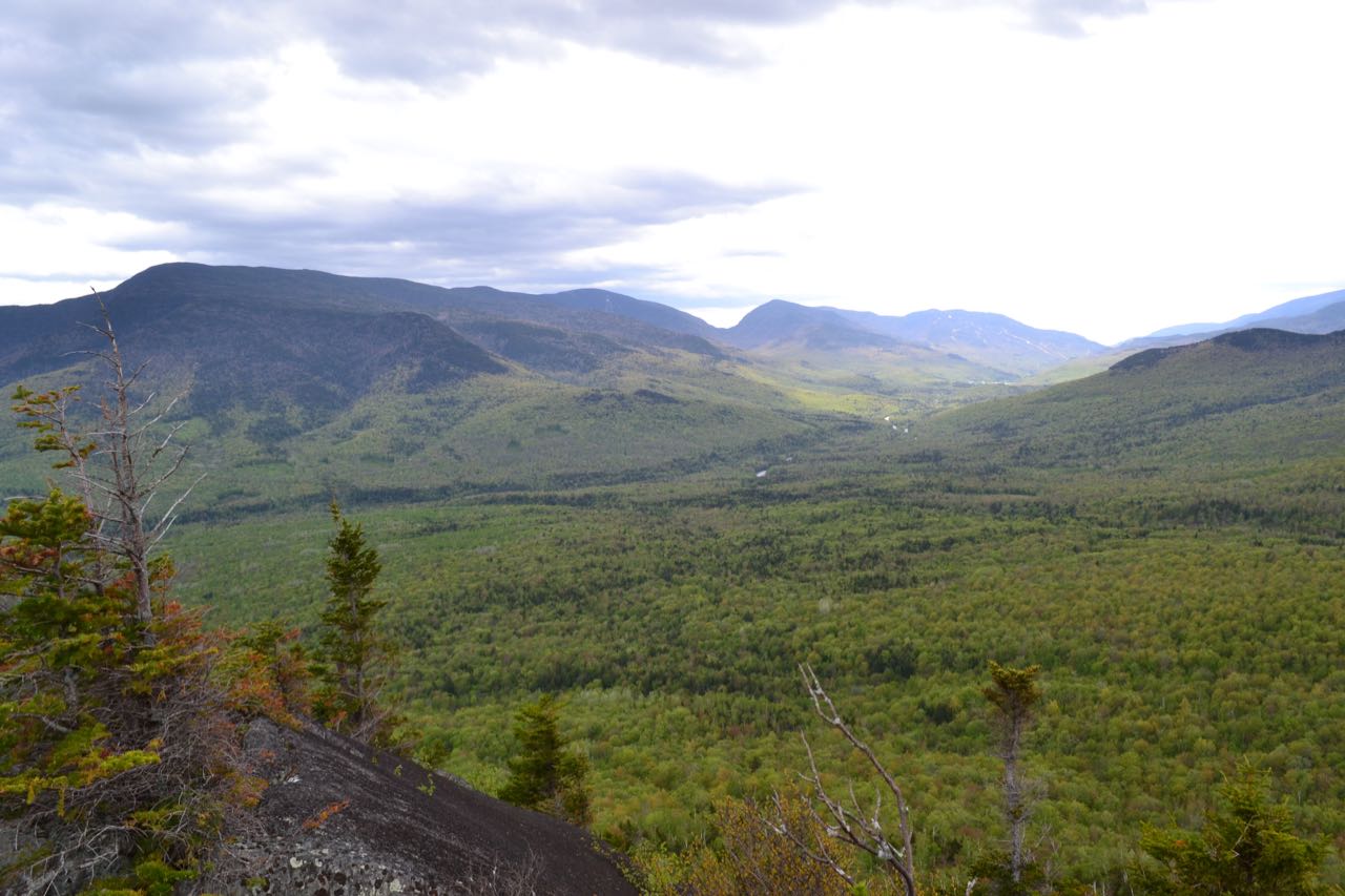
Begin your hike on the Pine Mountain Road, across the road from the Pine Link Trail. The road runs across a dip, then ascends at a slow pace over a southern shoulder of the mountain. After 0.7 miles, the road descends a short distance to a small col, with the summit in sight ahead. The road heads uphill again, and in 0.2 miles, a trail junction is reached. Turn right onto a forest footpath on Ledge Trail. The climb to the summit over the ledges is difficult, but short enough not to be too arduous. The trail climbs steeply straight uphill over rocky ground, then swings to the left, reaching the point of a right switchback in 0.2 miles. The trail runs level across the mountainside for 0.1 miles, coming out into the open and passing beneath an impressive cliff face. It crosses a small strip of forest, then reaches the first ledge viewpoint. From here, you have an excellent view contrasting high peaks with low valleys. Your attention is immediately drawn to the massive Mt. Madison rising above. Off to the left, you can look down in through Pinkham Notch, and see the impressive Carter Range on the east side, including Carter Dome, Carter Notch, and Wildcat Mountain. Off to the right, you look over the Moose River valley toward the Crescent Range.
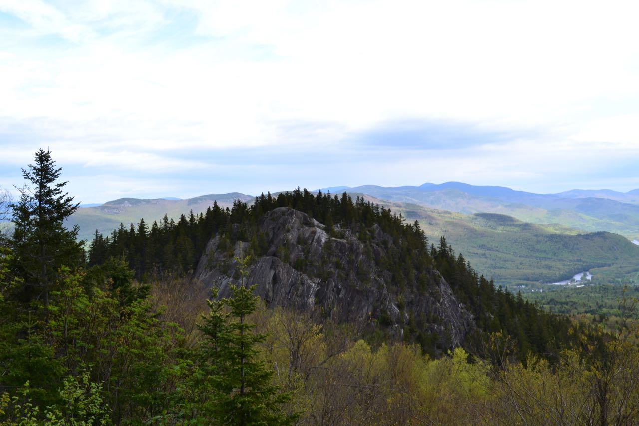
The trail turns left at this ledge and attacks the most difficult pitch of the entire climb. It struggles up a rocky slope, passing below a huge rock wall, then swings right and climbs up to a ledge, with some rock scrambling in just 0.1 miles. Another beautiful view awaits here. This viewpoint looks in the same direction as the lower one, but with a wider perspective. The trail turns back to the left at this ledge and climbs a short distance over to the most open viewpoint, atop round, windswept ledges. A bench is carved into these ledges, providing a wonderful place to sit and enjoy the view. The trail takes a right on these ledges. Follow blazes carefully back into the woods, where the trail leads up a much more gradual slope over forested ledges for 0.1 miles to the official summit. There is no view here, but there are the four cement footings from a fire tower that once stood at the location.
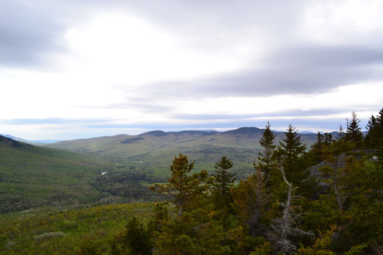
The trail bends left and continues past the summit clearing. It leads downhill at an easy grade for 0.1 miles, to a point where a spur path on the right leads out to a ledge viewpoint to the northeast. From here, you can see the northern part of the Carter Range, as well as the town of Gorham and the Androscoggin River and some of the Mahoosuc Range beyond. Not more than 0.1 miles more further down the trail, another path on the right leads to a similar view ledge where more of the Mahoosucs are visible. An even shorter distance down the trail beyond this, a spur path marked with a sign reading "Chapel View" leads out to the final viewpoint on Pine Mountain. Here, there is a wooden shelter along with a bench in the clearing. This viewpoint looks more to the north than the last two, providing a cool look at a huge cliff on a nearby spur known as Chapel Rock, where there is an outdoor chapel set up by the Horton Center. When you have finished taking in the views, head down the trail for another 0.1 miles to a four-way trail junction. If you have extra time to explore, taking a right at this junction followed by another right 0.1 miles later will take you up to the top of Chapel Rock, where you can look back toward the summit (not included in trip distance). To complete your loop hike, turn left onto Pine Mountain Loop (do not continue straight, as this is a private trail leading to the Horton Center). This narrow path cuts across the sharp hillside, avoiding the buildings of the center, and runs for 0.2 miles down to Pine Mountain Road. When you intersect the road, you can bear left and walk down the road for half a mile as it winds around the mountain, descending easily back to the junction where you first turned off into the woods.
Printable directions page